Documenting my 2018 East to West (then East, then West again!) trip across the USA.

Prequel:
I used to ride, a long time ago (22 years), both for fun and for work (courier in Los Angeles).
Until I began to run out of luck, and into cars. Several times in the space of 6 months!
None of which were my fault, but on my last trip to the ER I decided to hang up my helmet for the sake of myself and my young family.
The Trip:
Nearly a quarter century later, I took ‘voluntary redundancy’ from my job in the UK, and found myself in a position financially, and timewise, to have an ‘adventure’.
I’d always wanted to complete a trip from one US coast to the other. I’ve travelled the US, in part, several times before. I’ve piloted helicopters and light planes up and down various States, driven an RV from Connecticut to California (in 5 days), but always for someone else and on a strict schedule.
This time it was going to be for me, on my schedule, my term’s. But how?
I considered options such as Route 66, but the idea of endless hours of freeway pounding didn’t thrill me or fill me with enthusiasm. Then I read about the Trans America Trail And that did ‘float my boat’. It clicked.
Initially I considered doing it in my Jeep Wrangler. I had plenty of 4×4 experience both in the US and UK, having gotten into Jeeps when I got off bikes. But it didn’t quite seem ‘right’. Then my Wife suggested I do it on a motorcycle. That maybe it was time to ride again.
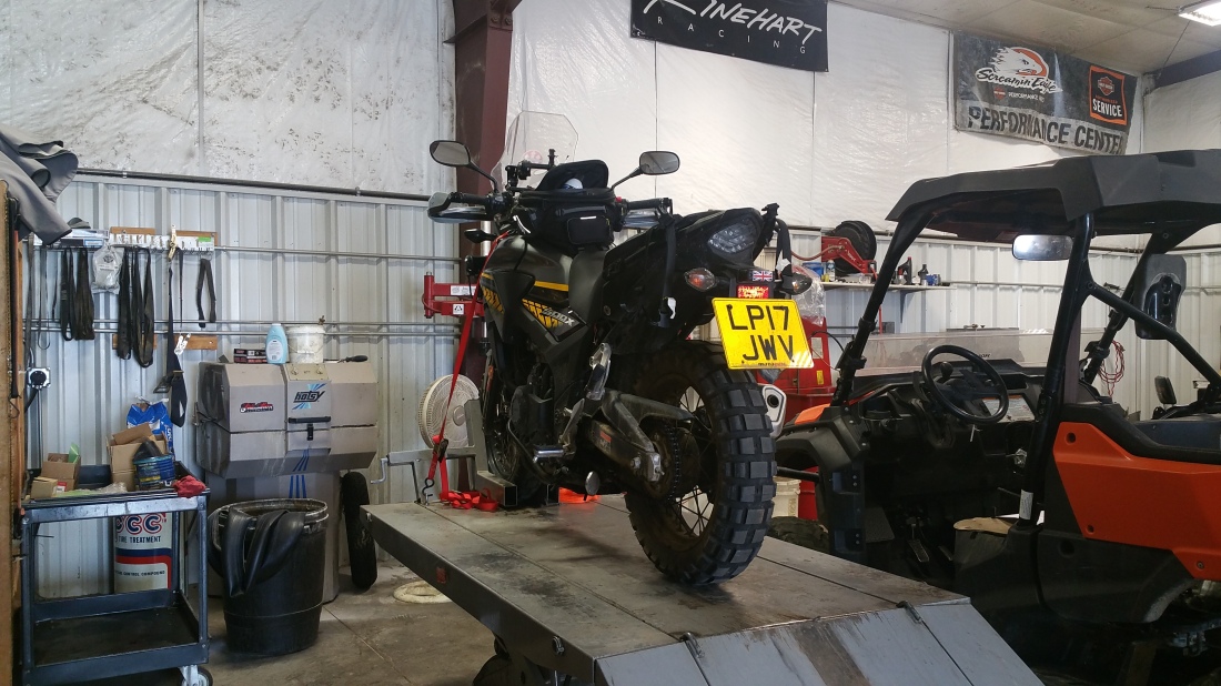
So, I signed up to take my UK bike tests and started to look around for which motorcycle I should use, eventually reading about the Honda CB500X, and how it could be turned from a mediocre commuter bike into an affordable ADV vehicle. Which brought me to Rally Raid and their various upgrade options.
My initial plan involved buying a used CB500X in the US, picking it up at the beginning of the journey. Fortunately this became problematic due to the requirements to register the bike in my name in the US. I say fortunately as I realise now that jumping on a motorcycle, after 22 years with only 5 hours of practice for the UK licence, to ride 5000 miles, would have been a bad idea. (and, as it turned out, I rode WAY more than 5,000 miles!)
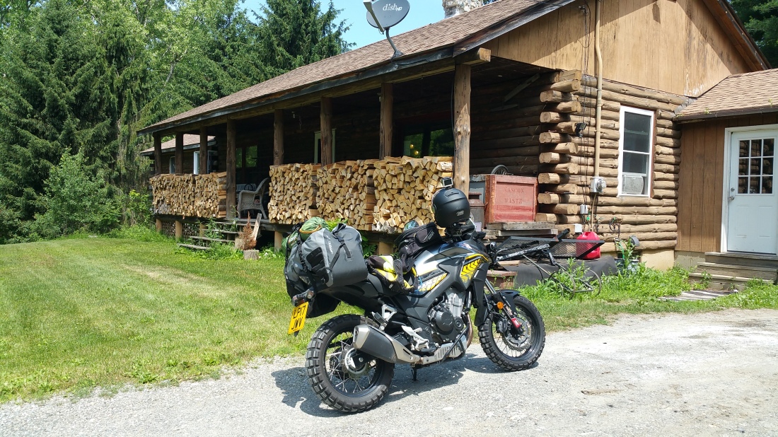
So I looked around for a UK CB500X, which is when Jenny Morgan told me about Rally Raid selling an ex demo bike. This one:

If anyone knew how good a Rally Raid equipped CB was, it would be her. As she’d already ridden the trail on a similar CB. After a bit of back and forth over which parts to leave on the demo bike, and which parts I didn’t need, and the price, I picked it up the day after passing my test!

The original plan was to leave later in the year, around late August, and work an IT contract to keep money coming in until then. However, that particular plan changed rapidly when the contract came to a sudden, screeching halt, three months early! So, change of plans. I literally came home from that last day at work, and called Air Canada to book the flights.
I chose to take the Air Canada method of shipping the bike, as their ‘Fly Your Bike‘ Program, financially is at least as good, or better, than sea freighting with the advantage that it flies with you and is instantly available on arrival (in theory anyway, I’ll get to that) rather that the 6 weeks of no bike while it cruises the Atlantic. And no “oh, we haven’t shipped it yet”, as has happened to others.
So, I booked the flight, for me and the bike and began the paperwork. Only to find that the only company who insured visitors and their vehicles to the US had pulled out of the market recently. It took some doing, but I found a US broker who had another option and the trip was back on!
After a couple of last minute panics over the EPA import certificate and the Canadian ETA visa (as I didn’t know I needed them!), I rode the bike down to Heathrow and Air Canada cargo, the day before the flight, to be booked in, x-rayed, and strapped to a pallet.

July 2nd
We’re on our way! Arriving at Montreal I dashed off the plane and watched to make sure the bike was a) actually on the plane and b) still in one piece. Fortunately both were true. Air Canada did a great job.
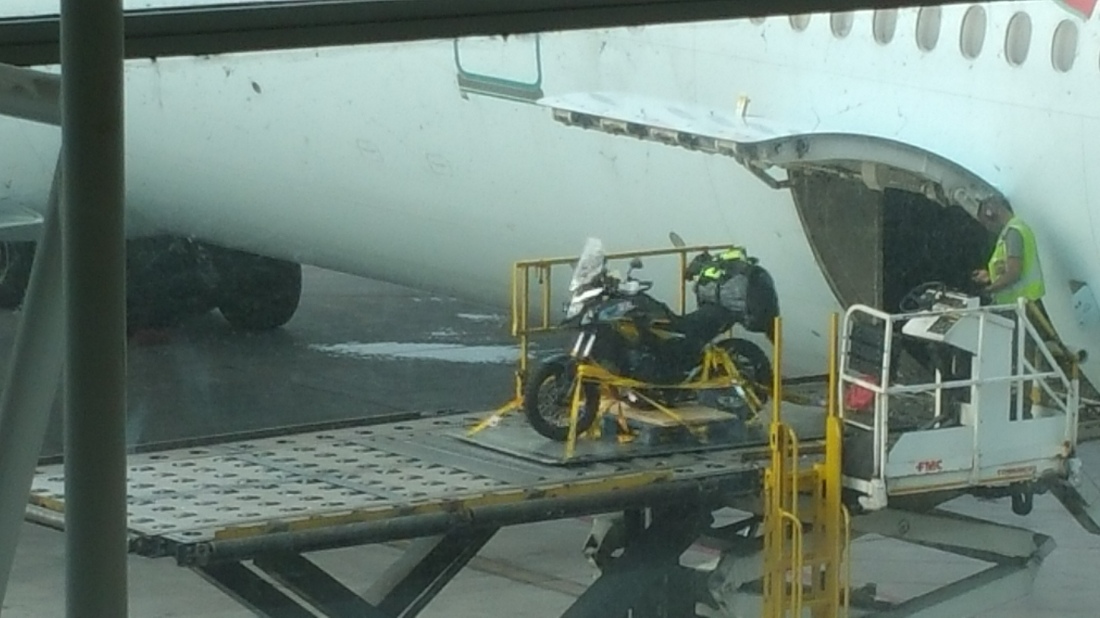
Once I’d successfully passed through Canadian customs, I took a taxi to Air Canada cargo on the other side of the airport. Only to be told that I’d have to go back to the terminal and convince customs to release the bike. Turns out the day after Canada Day is also a public holiday, so there were no officers at the cargo building and they are only supposed to sign off on perishables and live animals.
So, back to the terminal, and out with my best begging voice. Success! BACK to AC again with the all-important stamped paperwork, and I was reunited with the bike! Unstrapped it and rolled it off the pallet for a check over. All was good, so climbed into my motorcycle gear (in oppressively hot and humid weather), and set off on the first leg of my North American adventure. Grinning like an idiot, barely believing I’d actually made it!
However, my phone provider had decided not to play nice with the Canadian cell service’s, I had no Google maps to navigate my way down to the US border, fortunately I have a good sense of direction and I was able to find my way south. Where I dealt with my second set of customs officers in 3 hours. Who, fortunately, were as helpful as their Canadian counterparts and I was on my way in 20 minutes!

By this time it was late o’clock, so I rode until my initial excitement (omg I’m here!) wore off, and tiredness hit me. And stayed in the “America’s Best Value” hotel (it isn’t the ‘best value, BTW) in Plattsburg, NY. Where I was asleep as soon as my head hit the pillow.
July 3rd
Early start, and with my phone happier on the US cell services, I made my way to my friends house in Massachusetts, on my first full day of riding in the USA (after 22 years…).
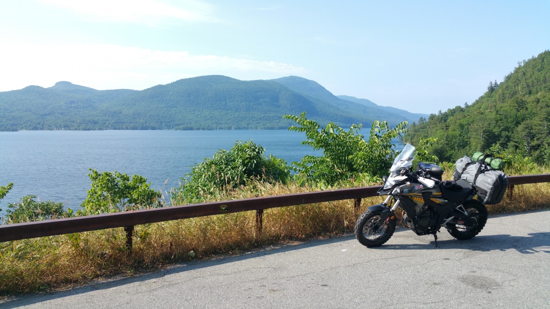
I avoided the main highway, instead picking route 9n. A very good choice as it turned out. It runs down the side of Lake Champlain and Lake George, providing spectacular views over the water along empty twisting well maintained roads .

Eventually finding my way to my friend’s house, in West Stockbridge, right on the NY/Mass border. Hadn’t seen Loretta in about 2 decades, so it was great to meet her, and her family again.
July 4th
Spent the day being shown around the area, going up to Mount Greylock,

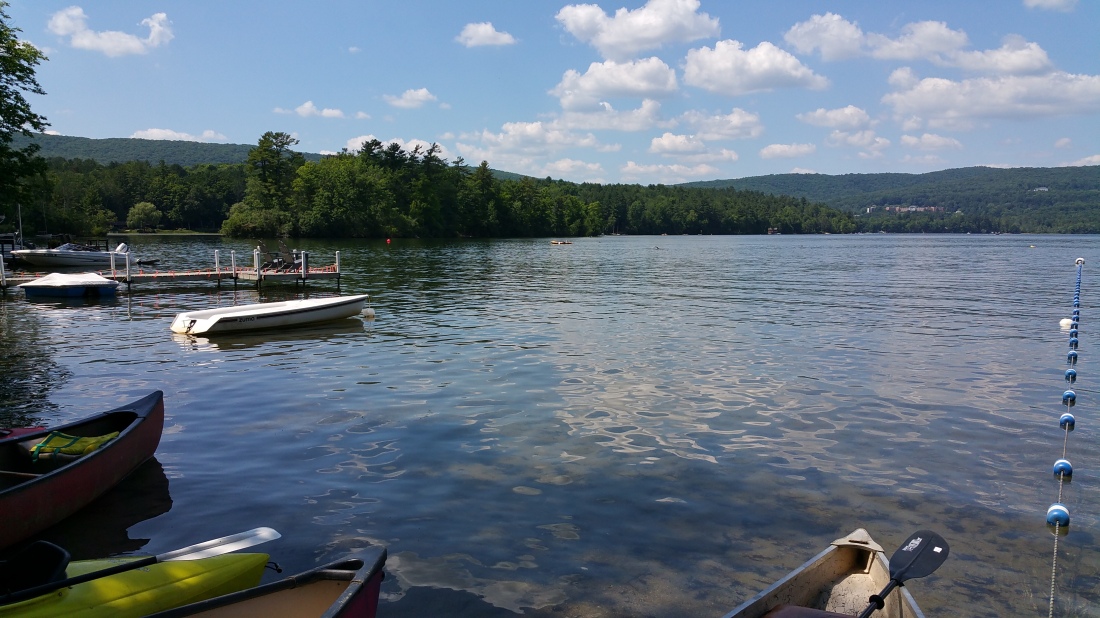
having a bbq at their cabin by ‘Stockbridge Bowl’ (the nearby lake)
and making the colonials do a double take at seeing the British flag on Independence Day!

July 5th
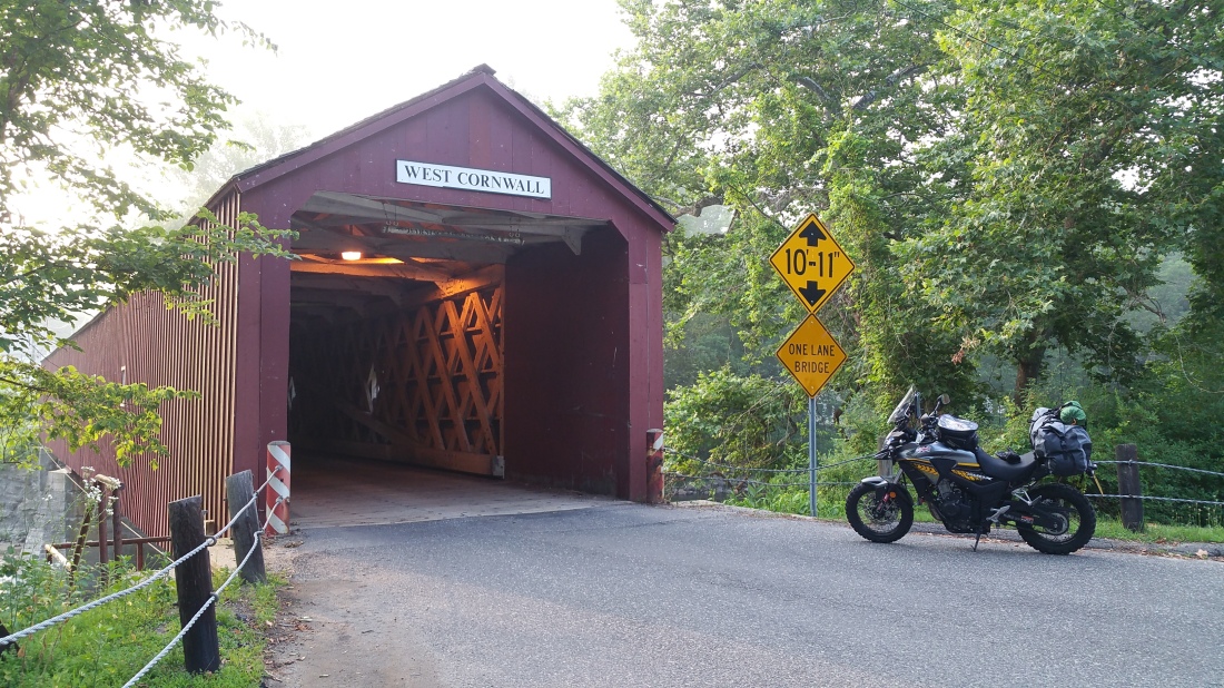
Back on the road the next day, with my sights set on my next stop; my Sister in Laws place way down in North Carolina. I chose route 7 over the main highway, again a good choice as it passed through several iterations of ‘small town America’ on the way to White Plains, NY where I took time out to visit my Father in Laws grave and say “hi”.

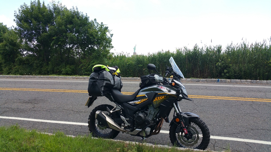
Then on into NYC, via FDR Drive into the heart of Manhattan, dodging the yellow cabs and hordes of I-zombies, still unable to quite believe I was actually doing this, to arrive at Times Square for a quick picture, while parked somewhere I probably shouldn’t have been..

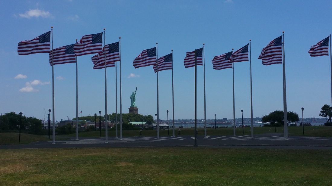
before continuing on Liberty Park where I tried, unsuccessfully, to convince the park rangers to put my bike on the waterfront for a pic with Lady Liberty. So I had to settle for an ‘over the hedge’ shot at a spot down the road.

Leaving NYC I headed south, through New Jersey on fairly nondescript highways, in very hot temperatures (this became a theme, roasting every day!) to Cape May and the ferry to Delaware,
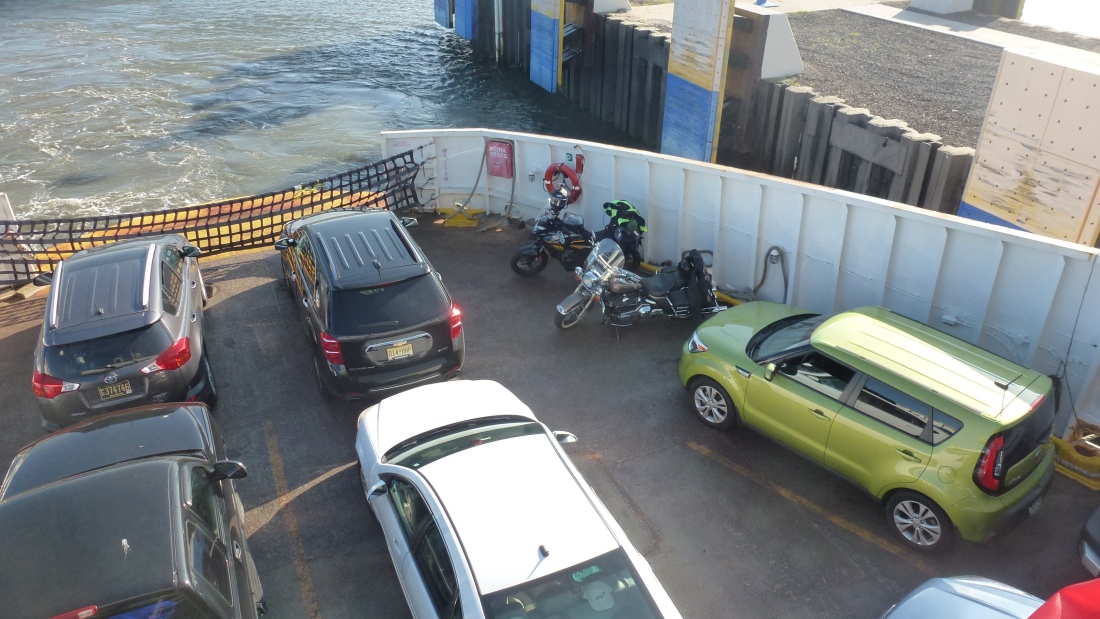
where I spent a pleasant 1.5 hours (and a beer) with the other biker using the boat. He proclaimed he was taking “a long road trip”, to Gettysburg… And was slightly amazed to hear my plans.
Off the ferry and yet more highway miles, heading south along US Route 113. Boring for the most part unfortunately, as it was just monotonous highway pounding, but with not terrible views down through Delaware and Virginia. Eventually finding somewhere to crash for the night in Pocomoke, VA, getting a solid 9 hours of sleep.
July 6th
Opening the room door at early o’clock I was hit in the face by yet another hot, humid day, and resolved to find a solution to my being slowly cooked in the Alpinestar Andes v2 jacket and thick gloves I’d been wearing. (And also realising my Vango Banshee tent had fallen off somewhere between Lewes, DE and the hotel!)
So I rode down to Norfolk VA, and found a bike shop (Cycle Gear, the first of many visits to that particular chain of shops!), picking up a Bilt Charger MX (mesh and armour) jacket and MX gloves, along with some chain lube. SUCH a difference. No more overheating and not having to ride in just a base layer t-shirt (not safe). Breakfast at the Bel Aire pancake house next door, then more highway pounding to Arapahoe, NC, to find my In-laws and my base for the next couple of days.
July 8th
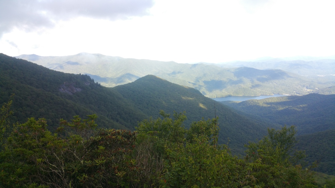
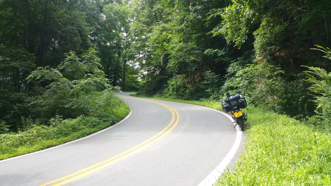
Long day. Left Arapahoe and headed to Cabelas outdoor outfitters, in Garner, NC, just south of Rayleigh, to buy a replacement tent, freeze dried hiking food, etc. Massive store! Then on the road to Boone, NC as I wanted to run the Blue Ridge Parkway down to Asheville. Had a great time on the 118 mile route. Loads of twisties opening up to views across the valleys. Plenty of other bikers up there too. Also explored some of the small towns along the way.


After a long and frustrating evening looking for a campsite, around Asheville, NC, to plant the new tent and get some much needed sleep, I gave up on ‘under canvas’ option and found a hotel instead.
9th July
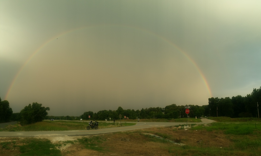
Finally joined the ‘TAT’, at Mars Hill, NC. Every kind of road in the TAT so far, from smooth tarmac to deep soft cinder, often different around every corner! But stunning views to be found, and not enough traffic to be unable to look away from the road. Strangely, one of the obstacles to look out for, after deer, rabbits and chipmunks (and the occasional snake) were box turtles. Who had decided the tarmac was a great place to bask in the sun. Grapefruit sized ‘organic’ rocks, often just in the wrong place. Speaking of rocks, the Rally Raid engine guard earned its keep. Bouncing off a large rock that I couldn’t lean round in time. An impressive ding in the metal, but not in the sump. So money well spent.
Bike has done fine, even with an inexperienced rider and a lot of weight up high. Got my left foot scraped a couple of times on the twisties. Not bad for knobbly TKC 80’s!
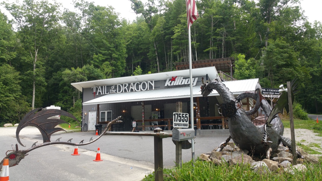
Left the TAT at Maggies Valley, NC. Had a beer to cool down in town, then headed up towards “Tail of the Dragon”, with the intention of running it after all the ‘yahoos’ had gone home. But sense (and fatigue) won out and found a place to pitch up for night instead. Wasn’t up for finding a place in the woods, but stumbled across the Iron Horse Resort Biker campsite and a good price (with WiFi, though it was very flaky).
Ended up next to a group of Australians who are travelling the US on their trikes that’s they shipped from ‘down under’.
New Cabelas tent went up. Quite impressed with it. Good quality and spacious. Plenty of room for my gear overnight if needed.

10th July
Packed up early, and rode up to Deals Gap,


to find and run the Tail of the Dragon. Heard a lot about it, how it was a great road to ride. 318 bends in 11 miles (or thereabouts).
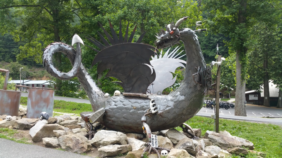
Found it, ran it, and TBH, didn’t find it that interesting. Perhaps because I’d already ridden so many similar roads over the last few days, including over 100 miles of the Blue Ridge Parkway. Still, crossed it off the ‘list’ and continued on the TAT.

Through more forests, and through Tellico Plains, the original start of the TAT.
Ran into 3 other people riding the TAT, and rode along with them until Ducktown, TN. Was good to have some company, at least for a while. They were on ‘little’ 250’s, so left me behind on the trails. BUT, on the tarmac between the trails, I would quickly reel them back in on the bigger 500cc bike!
At Ducktown, we had different plans, so I decided to jump ahead a little, and took the ‘slab’ around the edge of the Chattahoochee National Forest, to Calhoun, GA, where I found a USFS campsite for the night. No-one else there, just me and the fire flies. And the ever present humid heat!… As I was alone I was able to leave the fly sheet off the tent and sleep in the mesh inner, which made a big difference to being able to cool off.
11th July
From Calhoun, I stayed on the TAT, continuing through the Chattahoochee National Forest along winding forest roads, some of them very steep switchbacks, past LaFayette, TN, Mount Carmel and over Pigeon Mountain, with long vista’s over the valleys below. At one train crossing, I had an enforced rest break, while a seemingly endless freight train crawled past at about 5mph. Made me wonder about the people who used to ‘ride the rails’, during the great depression, and whether people still do it now.


Then onwards. Past Trenton, eventually arriving in Jasper, TN.
Took a break, then tried for Lynchburg and the Jack Daniels distillery. Got there too late for a tour, and the hotel in town was full. Found a bed for the night in nearby Fayetteville. And just in time too, as the heavens opened. Fortunately I was able to pull the bike under the porch, outside my hotel door. Keeping it dry and allowing me to replace the horn, which had self ejected somewhere on the trail.

12th July
Took a day ‘off’, to visit the Jack Daniels Distillery, and the town of Lynchburg, TN. Definitely a ‘must see’ if you’re passing through the area, of even taking a detour if you’re further away. The tour takes you through the whole distillery. From the huge storage buildings that contain around a million gallons of JD, each (there’s around 25 buildings), while the whisky matures (the smell is amazing!), past the area where they make the charcoal that is used to filter the whisky, which gives JD its unique colour, the spring where all the water that is used to make JD is drawn from, Jack’s office, the bottling plant, and finally on to the tasting room.


Didn’t go too crazy in the tasting room, as I had to ride down to Huntsville, AL to find a new rear tyre. Mine was totally done, but I’d had no luck finding a TKC80 at any store along the way. Fortunately Cycle Gear in Huntsville had one. But… they don’t remove the wheel. So, I strapped the bike to a tree in the parking lot, shoved an old car wheel under the engine guard and pulled the bike wheel off!


As I had started late, I rode on till sundown, and then kept riding. Even if some of the TAT required a detour. Fortunately detours were very few ( I only had to ‘go around’ about 3-4 times on the entire trail).

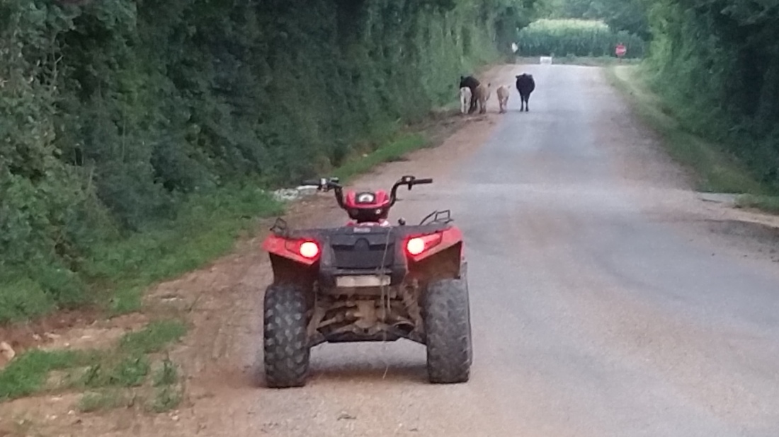
Came across a herd of cows that has decided not to stay home, found the farmer and between us we corralled them up and moved them to safety, on our modern day steeds!
Rode 20 miles of the TAT, including 4 stream crossings, in the dark. Fortunately the £20 LED lights proved to be a lot better than the price tag would suggest. Finally found a place to pitch up, beside the Natchez Trace parkway, in a car park for the Sweetwater Trail.


13th July
Woke up before the sun and rode down to Collinwood, TN at 04:30 loading up on carbs n coffee ready for the day ahead.
Back on the trail, which crossed over into Alabama briefly, through Waterloo, before going north again into Tennessee. More stream crossings, including one particularly nasty, very slippery one, that required me to pull off all the extra weight (bags etc) and carefully move the bike over to a safer crossing spot!


Made it to Counce, TN where I’d hoped to meet Sam Correro, the person behind making the TAT. Unfortunately, due to missed communications, this didn’t happen. But I did manage to reach out to another friend of mine, Brent, up in Jackson, TN where we had lunch and finally met each other after years of knowing each other on FB!
Headed back down through Counce, still unable to contact Sam, so headed south into Mississippi. Very rough trails, to the point where my windshield mounts finally gave out. So a side trip to New Albany and a hardware store where I found the parts to fix the flapping windshield.
Found a campsite in Pontotoc, MS. A quick negotiation with the camp owner resulted in a bargain rate and a night beside a very scenic lake, with my own restroom, and shower (mainly as everyone else was in air conditioned trailers/ RV’s!). Unbelievably humid. Taking a cold shower did nothing as I was unable to successfully dry off! At this point I was slightly ‘done’ with the Eastern US, and it’s constant dampness, and was looking forward to reaching the much more arid western side.
14th July
Headed into town, found a laundry. Much needed as I’d run out of clean clothes. Really wanted to wash my bike pants as they’d been wet, from sweat, for 2 weeks straight. But they would never have dried.
Followed the TAT, to near Oxford, MS where I’d arranged to meet another CB500X owner who wanted to meet me, and see how his stock bike would ride on the dirt. So, we set out and ran some trails together, eventually arriving in Oxford and had lunch before he headed home and I continued on, crossing the state line, and the Mississippi river, over a large metal bridge (Helena Bridge), into Arkansas.


Keen to explore, I headed up into the small town (Helena/West Helena) on the other side of the bridge, only to find a ghost town. Almost deserted, with most of ‘main Street’ shuttered and boarded up. Looking it up, I found that it’s one of the poorest towns in the US. Very depressing, so I got back on the trail.
Only to have the heavens open, and rain came down, in torrents! I frantically looked for somewhere to take shelter and put on my rain gear. Eventually finding an abandoned garage with 3 open (missing) rollup doors. Rode in there… and found that not only were the doors missing, so was the roof!
Pulled on my wet gear, though I was already soaked, and continued on down the trail. Barely able to see anything, between the heavy rain, and fogged up visor and glasses, I tried in vain to find a barn, lean to, large tree, to hide under. But nothing.
Out of the corner of my eye I passed a vehicle parked on the side of the gravel road. A Sheriff’s vehicle, with a deputy in it, who guided me to a nearby gas station, where I remained while the storm passed. The staff were helpful and friendly, though they thought I was nuts after hearing how I happened to be on their forecourt, so far from home. (they might be right!)
Once the deluge had abated, I set out to look for the “TAT Store”. One of the landmarks of the trail, where travellers stop to sign the visitors book and meet Al Faust and his family, who run the store.
As the water was still quite deep in places, I took the tarmac option heading west, before having to double back along the TAT. Couldn’t find the store coming from the ‘wrong’ direction, but a fella in a pickup stopped to check on me. Turned it was Al himself, on his way home. But he turned around and led me back to the store, for the obligatory picture and book signing.


At their suggestion I looked for and found a campsite in the Wattensaw Nature reserve. Not far from the I40, but still deep in the woods. I’m guessing the trail that runs past the camp sites is quite popular, as there was quite a bit of traffic driving by during the night. Including either a park ranger or a police vehicle, who pulled into my camping area for a looksee, before moving on. Nothing too scary, but a reminder that I was alone and far from home.

15th July
Another early start but already worth it.
Was taking pictures of the sunrise over the fields, when I saw a cropsprayer also getting an early start on the day, further down the road.
Got closer and got a few pics across the field, until the plane broke off and headed away. I thought it was going to reload, but then it turned and flew straight back up the road towards me.
He (or she) must have seen me taking pictures and wanted to give me a better shot!
When it came around again, i gave it the thumbs up and started on down the road. Only for the plane to loop round and we ended up having a drag race! Me on the tarmac and my unknown friend in the air.
It’s one of those moments. When you finally get home, tired, dusty and sad it’s over.
But then you’ll remember. Remember that moment, that is yours and yours alone. And you’ll nod, smile to yourself and think “yeah, that was TAT”.


Passed through Bebee, AR in time for breakfast, then on and up into the Ozark Mountains, passing through Scotland, of all places! Obviously not THAT Scotland, but was strange to see the name on so many town signs.


Made it along the Ozark Mountains, as far as Hector, before the 100f heat and humidity forced me to head downhill and cooler climes in Clarksville, where me and the bike cooled down in the shade outside City Hall (which has free WiFi!). Got back on the TAT at Mountainburg, Arkansas, caught out on the first big gravel hill climb and ended up with the bike sliding closer to the drop off with each attempt to move it.
So, unloaded the bags and kickstand turned it downhill, reloaded the bags and made a successful 2nd hill climb. A local stopped in his pickup truck to make sure I was OK, but did so on the same slope, only find that getting moving again, in a 2wd truck wasn’t easy!
Followed the TAT through Westville, OK and into the hills where I setup camp, while noticing the occasional lighting flash from far away….
16th July
Woke up early this morning and the gap between flash and bang was down to 14 seconds, then 9…
So I ‘decamped’ back to Westville. Right choice as the rain began while I got coffee at the gas station, and waited to see what happened. The doppler had activity about go right overhead.


So I made the decision, to head north instead. Took the 59 up as far as Grove, OK. Then turned west. Was skirting round the rain, the leading edge of the storm perhaps, even up there.
Didn’t really have a plan, so just put the sun at my back to navigate by (made my ‘enemy my friend?), turned off all the maps and just rode… Thataway.
Eventually stumbled across Vinitia, OK, which turned out to be part of Route 66, so I decided to’ get my kicks’ in that direction for a while before exploring some more.


Later, I found myself on Route 11, so stuck to that. It’s as straight as an arrow, pointing west, and definitely ‘slabbing’, but needed to stick to something for a while.
Came across a massive wind farm, laid on the land that used to be covered in pump horses. The image, of the massive new turbines, standing over the bones of the old pumps, pipes, and tanks really stuck me.

The other thing that struck me, while being ‘lost’, on purpose, was that I needed this. I’ve been following lines on a map since I arrived. Whether Googles or Sam’s, but not mine.
And that’s what I’ve been missing. I came with the intention of finding my way round the US, and I’ve instead been lead around. Which has not been a bad thing. But, I’ve realised, not MY thing.
I’ll pick back up on the TAT, but I needed today to get back on track. (so to speak…)


17th July
Headed north, to Dodge City, Kansas to find a Harley/Honda dealer (an odd combination!) and give the CB some proper mechanical attention. Oil and filter change, chain scrub and lube, etc. I’d hit 8,000 miles on the odometer, so it was time to take care of my ride.
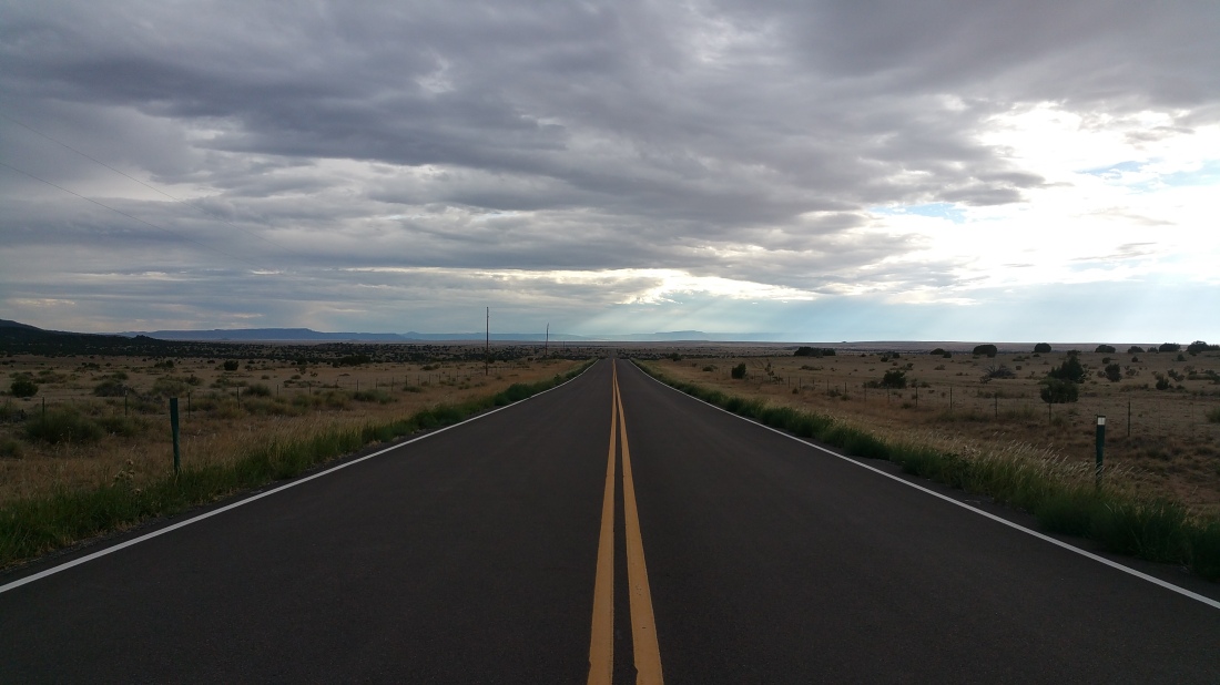
Then west, into Colorado, hoping to leave the big empty that is Oklahoma and Kansas behind.


As it turned out, Eastern Colorado is as flat and featureless as OK! Miles of not much to see on arrow straight roads.
Though things turned interesting around Pritchett, CO when a storm came rolling in from the other side of town (and of course right over my route). So myself and some other 2 wheeled travellers took shelter, temporarily, in the only bar/café in town .


When the sky had cleared, I continued on to Trinidad, CO and the “Trails End” motel. Owned, and run by, bikers (of the MC variety). But friendly enough, even offered to share their weed! (politely declined)
18th July
Took a walk around Trinidad, which was known as “Sex Change Capital of the World”, due to a local doctor pioneering the field. Though I didn’t find the doctors, I did find a much needed launderette, before packing and getting back on the TAT, across scrubland and high desert type land.


For some reason, my phone decided it didn’t want to be in it’s mount anymore, and ‘jumped ship’, twice along the trail. Fortunately I noticed quite quickly that my ‘sat nav’ had disappeared, and even more fortunately had survived it’s crash landings. Otterbox cases are worth every penny!
Pulled into La Veta, CO, just in time for lunch. Found a spot right on Main Street, along with an empty bench right outside the deli. So, spent an hour people watching (and secretly enjoying being around humans for a while after so much time alone) before pushing on.


Followed the TAT from La Veta all the way to where it connects to route 96. Jumped off there as Jenny Morgan had suggested a route up to Pikes Peak. However, due to the late start it was already 5:30 and would have taken me 1.5 hours in the wrong direction.
So, slabbed through the canyons to Silver Cliff for fuel and frappucino (my TAT fuel stop drink of choice for some weird reason…) Before reaching Salida, CO, for dinner and a campsite just outside town.
19th July
Today was going to be a challenging day, as it was time to ascend through the Rockies, on trails i’d heard could be ‘challenging’. The terrain, from Salida, climbed steadily upwards and became more ‘Alpine like’
Bumped into a large group riding the ‘BDR’ (Backcountry Discovery Route) and stopped to say ‘hi’ for a while.


After getting over Cinnamon Pass (over 12,000 feet in altitude) I arrived in the ghost town of Animas Forks. One of the highest ghost towns (11,000 feet) in the US, and a popular staging area for adventurers exploring the various passes that run through the Rockies. Found a group of Jeepers in ‘FSJ’s’ (Full Size Jeeps) like mine, so I was distracted for an hour or so!


Apart from the Jeepers, there were a lot of buggies (UTV’s) running around the trails, so rather than mix it up with them, on trails more challenging (with large cliffs!) I decided to take the tarmac down to Silverton, a former silver mining camp, (clue is in the name!) most or all of which is now included in a federally designated National Historic Landmark District) nearby and spent the night there. Camped right next to the river, along with another rider from the TAT, who has become 1/2 of a duo after his buddy had dropped his motorcycle off one of the aforementioned cliffs! Fortunately he was OK, but his bike was a write off.


20th July
Set off slightly later than planned due to the owner of the camping store in town not showing up, so no food bought there!
Got up and over Ophir Pass (also known as “OH, F…… EAR!) also over 11,500 feet up), a very rocky and steep trail with only a small amount of swearing. Going up, from the eastern side was fairly easy. BUT, the steep descend involves a 1/2 mile or so of ‘babyhead’ rocks, so named due to their size. Unlike babies though they are not cute, not cuddly. Riding over them is treacherous as they roll over each other, sending your bike sideways when you least expect it. It’s where my ‘guest’ at camp last night lost his riding buddy. I ‘only’ had to drop the bike twice. Mostly to stop it careening downhill (and over the cliff when momentum and gravity took over. Barkbuster guards on the handlebars made laying the bike down a safer process and nothing was damaged. BUT picking up 400+ lbs of bike, at oxygen thin altitudes is not easy, especially for someone who lives at sea level.

After successfully navigating Ohfir Pass, without serious incident, I went through the towns of Rico and Dolores. Which are not, surprisingly, named after Colorado’s answer to Bonnie and Clyde, but rather old silver mining towns. Took the tarmac partly to explore, partly to recover from the passes, and partly to look for camping food.

Rejoined the TAT at Dove Creek, crossing the Utah State line and continued on the “3 step hideaway”, another TAT landmark/stopoff/garage. A collection of buildings in the middle of nowhere, that have been built as a hotel by the owners. No-one was in at the time, so I played with the dogs until Scott and Julie rolled up. Was great to meet them, Scott looked around in the barn for a rear tyre, as the tkc80 I bought in Huntsville, Alabama was already done. TKC80’s, not TAT approved, imo. Great tyre, no longevity.
So, on into Moab at Scott’s recommendation, to Mad Bro motorsports. Who had both TKC80’s and Shinko 805’s in my size. I went with the Shinko this time. Should last the rest of the trip. Stayed in downtown Moab at a hotel right in the middle of town. A chance to sleep in a proper bed, eat proper food, and do laundry. (and sleep in air conditioned comfort!)
21st July
Up at sunrise this morning for a ride through Arches National Park. Avoided the crowds, heat, (and the $30 entrance fee, as the booths were still closed). Really worth doing. Rode the tarmac, and unpaved areas to the west of the park. Another ‘must see’ if you come here. Though the ‘back trails’ in the park are quite deep, sandy and tricky if you’re on two wheels.


From Moab I had a long day ahead of me. A ride all the way down to Las Vegas, about 450 miles, of highway, in 100+ degree temperatures. But I’d already planned this diversion, as I wanted to ‘go home’, to L.A, and visit family and friends for a week.
So, Highway 70 and I15, for a seemingly endless day of riding. Apart from fuel stops, a break to avoid a storm (at Beaver, UT), another break to watch fire fighting efforts on the hills nearby, AND a sudden stop to pick up my faux pro when it fell off my helmet (it survived, the SD card didn’t, so I lost almost all my videos so far!)


Arriving in Vegas, on a Saturday evening, I found it was everything I remembered from my last visit, over 20 years before, but even more crowded, hotter, and less enjoyable.
What I didn’t find, was the chapel where we were married, over 25 years ago. It WAS right next to Circus Circus, but now… wasn’t.
I was exhausted, frustrated, hot, crowded, lost my videos, and a piece of my history. A low point of the trip. I escaped ‘Sin City’ and rode down to Jean, NV, for a hotel (the ONLY hotel in town) for the night.
Fortunately the room was comfortable, air conditioned, the beer was cold, the food good, and I found out what had happened to ‘our’ chapel. It had been donated to the Clark County Museum! Dismantled, piece by piece, moved and reassembled in the Museum grounds. Not sure about my past being in a museum, but slept better knowing it wasn’t just ‘gone’.
22nd July
Found this during the ‘preflight’ this morning. Tread separated from the tyre. How it didn’t go pop during yesterday’s 450 mile ride I don’t know
My guardian angel is asking for a raise.

My quest for a front tyre was a complete bust. No-one that was open in Vegas today (Sunday) had anything.
Found a shop in San Bernardino, CA that has tkc80s, 225 miles away. However that’s 225 miles along the road to L.A, my route.
So, I rented a uhaul, Strapped the bike in the back, and was back on the road, heading south.
Bonus; air conditioning!
Sunday evening traffic out of Vegas was… as expected. Nose to tail, for miles. Clue should have come when I filled the Uhaul tank, at a southbound gas station that had 95 pumps! But, turned a bad day into a good day. Found a solution to finding a tyre, and still continuing on the way to L.A. And got to meet Dan Cole, presenter and owner of the 4×4 podcast, along with Stephanie and the various smaller Coles. And I got to have an In n Out burger, for the first time in years!
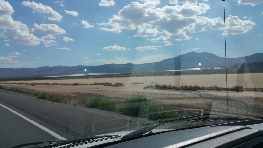
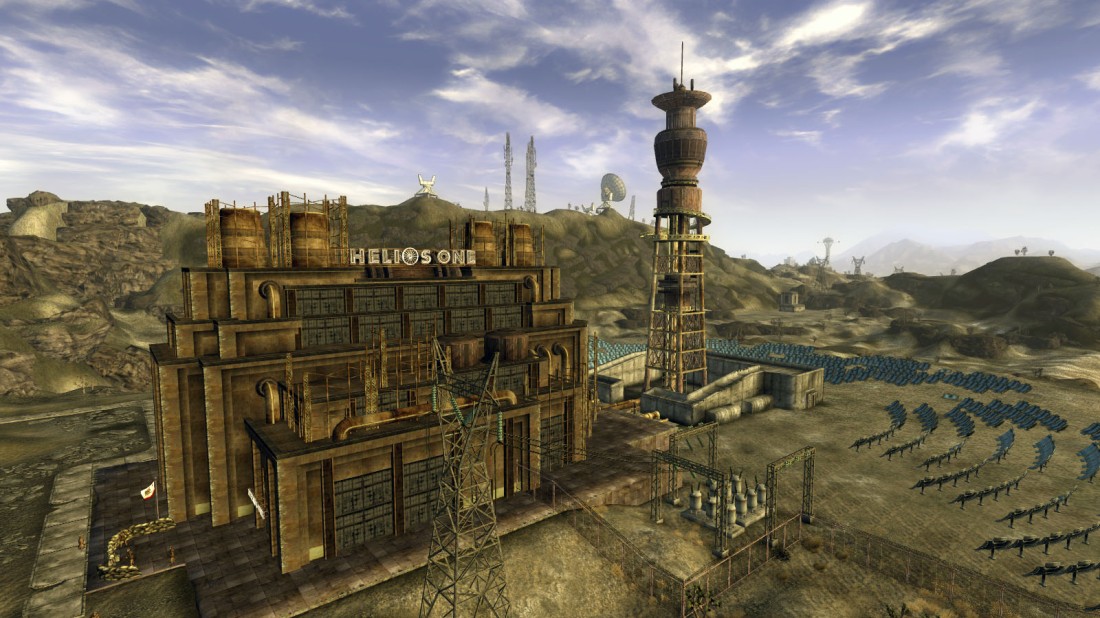
Passed the solar energy power stations on the way south, which always remind me of ‘Helios 1’ from the video game “Fallout New Vegas”!
Got into San Bernadino very late, found a “America’s Best Value” (it isn’t!) hotel, parked the Uhaul right in front of the room and was asleep in seconds.
23rd July
‘Operation bubble tyre’ started early this morning. Dropped the Uhaul off at the depot, which was an adventure in itself. The first depot marked on Google maps was still closed, so I drove to the next one, only to find it was only a maintenance depot, and didn’t take customer returns. Which I found out AFTER offloading the bike! Fortunately they took pity on me after hearing my sob story and let me leave the truck with them.
I rode, carefully, the couple of miles to Chaparral, the bike store, and waited for it to open.
The place is HUGE, but had the front tyre I needed. I took it to the counter, agreed to take the wheel off the bike myself (saving $50!) and ended up making a bet with the fitter who refused to believe the spoked wheel was tubeless. I won! So my fitting and balancing was free.
I used my Rok Straps, the parking lot railings, and the sidestand, to pull the bike over enough to lift the front wheel and remove it, got the tyre fitted, and headed south to L.A, for a few days break.
28th July
The plan, while in L.A, was to meet a friend of mine and ride The Mojave Road. However, the forecast was for 118f temperatures during the 3 days we would have been in the desert. Also, Chuck didn’t want to ride his 650lb BMW bike across 140+ miles of desert trail. He did want to drive his Land Cruiser instead, but I felt a 30 something year old truck in heat like that, miles from help, would be a bad move.
So we wisely decided to ride the Pacific Coast Highway, up to Monterey instead. Big Sur had just reopened following the landslide a couple of years ago, so the timing was right.
Had a great ride, even turned cold in places, which was a change to what I’d been used to, for weeks!


When we arrived in Monterey, we were fortunate enough to crash for the night at a friends house.
29th July
Leaving my friend behind, I set out alone again to head east and rejoin the TAT.
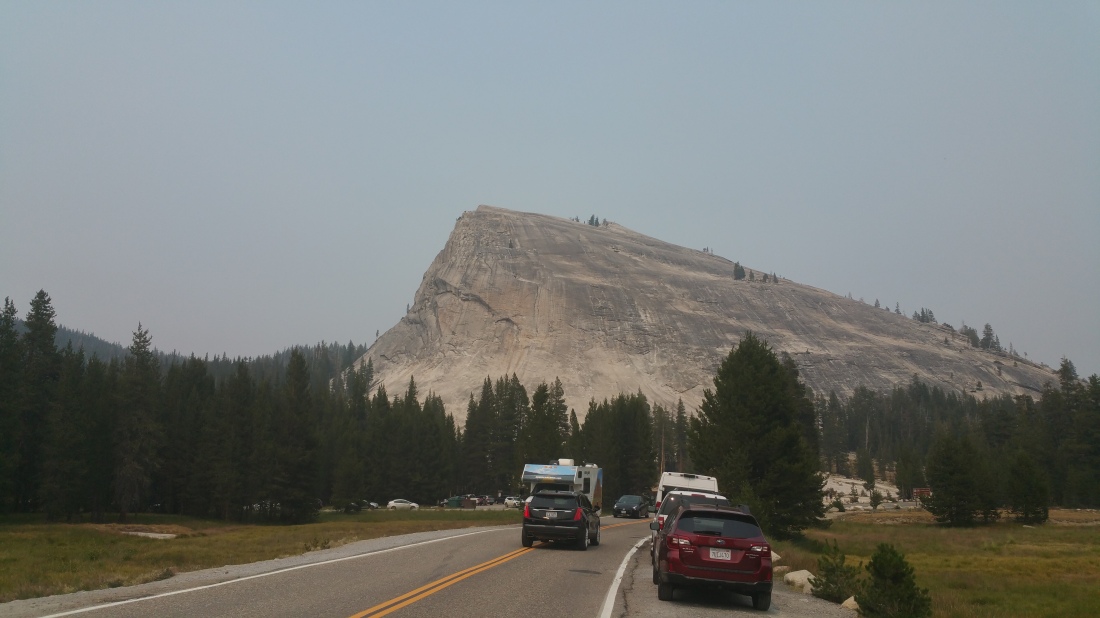
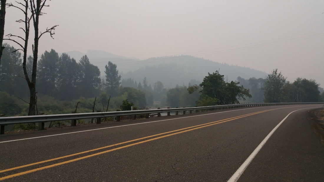
Another long (400 miles) day of riding. Left Monterey early this morning and had to deal with multiple road closures getting onto the 120 through Yosemite, due to the fires.


Once in, the view was… restricted. The smoke reducing visibility down to about 1/2 mile. So not so much scenic views. Only one of the lesser half domes was visible, and only as it was right next to the road.
The upside was that the forest service had closed the gate booths, so no having to pay to look at smoke!
Exiting at Lee Vining/395, the haze was still thick enough to spoil the views across Mono Lake, so I headed south, to June Lake to find the hotel my Wife and I spent our first Xmas, 28 years ago.


It was fully booked, as were all other hotels in the town centre, so I rode a little further and found a…. not so nice place down the road.
Was going to wild camp, but need a shower and bed. Another long day tomorrow before I get to the TAT.
30th July
Another long ‘slab’ today. Checked the bike out last night, and found that the ‘split link’ on the chain had done just that. Split! Only half of it was there. I found some wire and fixed the remaining half in place. But, There wasn’t a single bike shop along the whole, long, section of the route. So I had to big a big detour, north, to find a $2 item. The day ended up being a 480 mile slog from June Lake, CA to Ely, NV via Reno and US Route 50. Which is billed as “the loneliest road into America”. Probably because “400 miles of NOTHING to see” wouldn’t have had the same draw.
Literally mile upon mile of nothing. I almost began to miss the ‘scenery’ of Oklahoma.


Almost…
There are about 3 small towns along the whole route. One at either end and one in the middle. All relying on the passing tourists to stay alive, so I stopped in Austin (the halfway point) and had lunch at the diner.


BUT, this was probably the last long ‘slab’ (tarmac only) ride of the trip. As of tomorrow I’m back on the TAT!
I was considering wild camping tonight, and had begun to check out potential sites by the side of the 50, until two decent sized coyotes strolled right through the most likely site.
So, came into town instead! And stayed at the Hotel Nevada. One of the oldest hotels in the state, and also briefly the tallest building in Nevada (6 floors!).


31st July
Back, on the TAT. From Baker to West Wendover, NV. Following the route of the Pony Express along its path on US Route 50 yesterday and now north on 180 miles of gravel road with just nothing out there. Definitely a sense of just how isolated you are, and how far from help.


Signed the visitor book at canyon camp, but disappointed to see another TAT’er thought it would be OK to sign the box the book is kept in…
Stopped in Gold Hill, but don’t think there’s much gold there…


And found, by chance, a WWii German Panzer by the roadside!


From Wendover to Tremonton, UT. Trail north of Wendover was rough. So much washboard! But eventually smoothed out leaving a very pleasant gravel, mud and occasionally sandy ride. Watched the forest forest in hills to the north east, but far enough away not to be concerned.
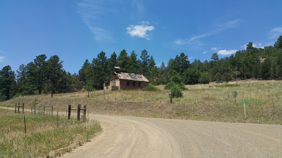
Eventually reached Kelton. Originally a main line station for the Trans Pacific Railway, now almost nothing remains, except the ruins of the hotel and graveyard. Along the trail after leaving Kelton there are small placards showing where the smaller settlements along the railroad used to be.


Finally reached tarmac, after about 300 miles of gravel, and showed the appropriate amount of joy! Got off the bike, and kissed the ground! Prematurely as it turned out, as the tarmac turned back into gravel a little way down the road. But eventually gave me what I needed.
Found a empty campsite just over the Idaho border. Empty except for the camp host anyway. Didn’t mind giving him the $10. I’d free camped at plenty of other places along the way, so I was ahead on camp fees really.
1st August
Hello, Idaho! Very nice ride up from near Holbrook this morning. Stopping at American Falls for fuel and coffee (and one of the huge cinnamon rolls they make at The Ranch gas station!). I’m surprised how picturesque Idaho is. I stuck to the tarmac to begin with as it was clear that the TAT route was just criss-crossing the valley road just for the sake of being on gravel.
After I crossed The Great Rift and made it to Arco, ID, I decided to go and see Craters of the Moon national park. Definitely a good choice. A must see if you come through here on the TAT.


After Craters, I picked up the TAT again, with the intention of wild camping somewhere along the trail.
My campsite was picked a little earlier than expected, just as I got to Challis national forest, the CB felt ‘off’. Pulled over and found I had a flat rear tyre. Found a huge fence staple right in the middle of the tread. So, out with the Safety Seal plugs and compressor. No drama.


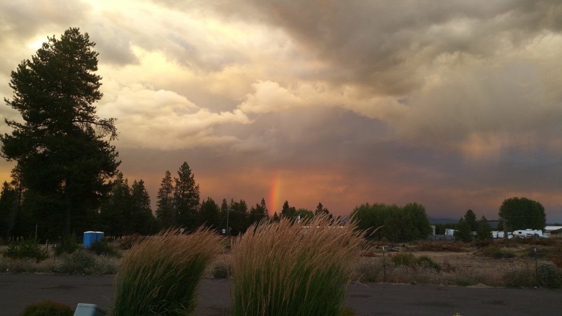
So set up camp, right by the cattle grid entrance to Challis. There must be a fire somewhere nearby as there was ash falling all night, along with the ever pervasive smell of smoke.
2nd August
Set off at 7am to climb over the mountain pass. Stunning views on the way up, and the trail wasn’t too challenging. But the views all the way down the back, to Ketchum! Amazing!


Rode from Ketchum along the TAT, on route 227, passing the road closed signs, to Smokey Bar Cafe. Got an update from Rick, a local, to say it’s still fubar, so played it safe and dropped down to Fairfield.
I know others have gotten through, in a group, to help carry their bikes. But I’m on my own and lugging 400lbs through washed out roads in 90f has ZERO appeal to me.
So stopped at the convenience store in Fairfield, downing Gatorade and Cliff bars. Fortunately I decided to just chill here, as for the first time on the trip, I left my wallet at the checkout! OOPS!
Rode the tarmac up to Featherville, ID and found a hotel for the night. Wasn’t too hard to find, as there’s only one hotel. And one bar, one diner, one shop, one gas station with one pump…
Yes, it’s a small town! and basically for sale!


3rd August.
Rode over the mountains from Featherville, Idaho, to Idaho City this morning. Another great ride. Very tricky in places, with long drops if you weren’t paying attention.
But once down the far side, the trail followed the Arrowrock river all the way to the Arrowrock dam with stunning views round every corner. Met up with two New Zealand visitors, while riding this section of the trail. They’re also riding the TAT on their KTMs, before turning south and riding the Great Divide route south. And then I met two more TAT riders from MO at the gas station in Idaho City. Good to know I’m not the only one out here, though we are infrequent ‘bikes that pass in the night’ (or, day).


And then, without any real fanfare or a stateline sign, there is was. Oregon. And it hit me, this was the last state. My TAT was nearly over. I found a spot to camp, next to the Snake River, looking back at Idaho on the far bank, and experienced both sadness and relief that the trip was nearly over. In a day or two I would be at the Pacific Ocean.

4th August
Not the best nights sleep. Turns out there was a railway just a few hundred yards from where i’d pitched my tent, and it was quite an active freight train route throughout the night. Then there was the wind going crazy in the middle of the night, and trying to blow the tent back across the river, into Idaho! Had to take off the flysheet and let the air blow through the mesh inner. While wrestling with the tent, in the dark, I managed to step on a tent peg in bare feet. Ouch!
Came back down to Ontario, OR, for supplies, fuel, and laundry as the next sections seem quite remote.
Ontario, OR to John Day, OR. Now this is the Oregon I remember! Once the TAT rose up and into the treeline, the scenery went from endless brown dusty hills into shaded forest land. Enjoyable climb up on decent trails, with just enough rough parts to keep you on your toes.


And then the trail emerged onto the forest road. Loved that. Miles of smooth tarmac twisting through the trees. Like Blue Ridge Parkway again, but with zero traffic. Just keep a look out for the cattle, and what they leave on the road…
A welcome relief, as the tent peg i’d stepped on had put a hole in the bottom of my left foot, making gear changes while standing up painful.
Arrived at John Day to find two other TAT’ers heading out. One from Germany and one from New Jersey.
Found a great campsite, in the showgrounds just off Main Street. One of the few times on the trip where I was able to pitch a tent that wasn’t miles from anywhere. I wasn’t the only biker to find this site, and there ended up being quite the gathering. Including a Canadian and a New Zealander on SV650’s exploring any and all the twisty roads in the area, and a group on Harleys going up to Sturgis. Had a good time swapping road stories and downing a few beers.


5th August
John Day to Prineville to La Pine, OR.
A strange weather day. Started out very cold, so cold that I had to stop and warm up on the TAT. But by the time I reached Prineville, it was baking hot. Then up to the volcanic calderas of East and Paulina Lakes, where it was cold again and raining. Down to La Pine, hot again!
Still, a lot of good trails. The rocks and ruts sections on the way to Prineville, then the Crooked River Highway being the best.


Looked at camping up at the lakes, but way too busy. And cold and wet. So came back down to the lowland looking for a site instead.
Where I pulled a decking screw out of the rear tyre, and plugged it. Again…
After plugging the rear tyre, I looked for a hotel in La Pine. No luck, all booked. So looked for a USFS campsite. First one was closed, second one was open. But, had a very weird vibe. Could have been because I got stuck, down to the rear axle, getting in. Could have been the homeless guy, sleeping in his car across the way. Could have been the procession of dodgy looking people driving up and down the dirt road. Could have been that the very large ants figured out how to get into my tent within 3 minutes of putting it up.
So, I bailed. And got stuck again, trying to get out. Repacked and looked for somewhere else. On the way south I looked back at the calderas where the nice campsites are. Clouded in a thick storm, with lightning. Glad I didn’t stay up there, as anyone in a tent would have been miserable!
Tried several other likely sites, without success, as it got darker and darker. Finally arriving at an out of season Sno Park. In the dark. Found a spot on the grass next to the car park, and pitched up.
6th August
Woke up this morning, freezing cold. Got dressed and looked around in daylight. There was an unlocked warming hut 20′ from my tent. Could have stayed in there and been warm!
So, packed up and found coffee and fuel down the road, then back on the TAT.


Jumped off at Crater Lake and did the tour of the rim, visited the information centre to watch the history of the volcano and how the lake was formed, by the top of the volcano exploding and collapsing into the cavity beneath.


Then headed to Tiller, OR, through thick smoke, fire camps and helicopter landing pads. Tiller was a ghost town. Didn’t see a soul and the fuel station is closed. So shot down the hill to Canyonville, much needed fuel, and a hotel.

Last part of the TAT tomorrow. Looking forward to it, and also not looking forward to it.
7th August
Followed the TAT, until running into a section of downed tree’s blocking the path about 20 miles from the finish line at Port Orford. Left the bike and climbed over tree after tree to see how far back the blockage went, which was several hundred yards. Fortunately a bypass was in place, across the top of the nearby ridgeline and down to the canyon road heading west.
And so, here I am. The Pacific Coast. Port Orford. The end of the TAT. Five weeks, 9700 miles, 21 states.
Feeling just a little bit stunned. Trip of a lifetime. And now it’s done.


Almost anyway. Still 5 days before we (the bike and I) fly home.
So, let’s see what happened between here and Vancouver!
After crossing the ‘finish line’ at Port Orford, riding the bike down to the beach, spending 20 minutes digging the & #*£ing out and wrestling it back up the slope to safety, I looked for a place to eat. Found “TJ’s pub” just down the road. My initials are TJ! Karma?
Then back on the road. Heading north, slowly, via the coastal loops. Stopping to take pics and explore.


Eventually the increasing marine layer, and decreasing cold, pushed me inland. So I dived off and took the 38, Umpqua River Road. Good choice. Very scenic canyon run with the river alongside.
Bonus was the herds of Elk in the fields beside the road.


Was pushing for Eugene, but the hour was getting late, so pulled in at The Lucky Duck RV and campsite. Loads of RV’s, but the tent area is empty, clean, grassy and very close to a cell tower! (it’s also next to the 5 freeway, but hey ho). And while the camp warden/host trailer was right next to where I’d pitched up, he didn’t come over to collect the fee’s!
8th August
Took more back roads up to Eugene, just a short distance from where I’d camped. I’d arranged to meet a friend, Kate Alford, that evening, so i explored downtown Eugene and wandered round the Natural History Museum, before finding a hotel to dump all my stuff for the night. Was a good evening out, at the Oakshire pub.
9th August
Wandered up towards Portland, OR, via route 99w, and McMinville Museum. I’m sticking to tarmac, despite many “hey ride these trails” suggestions, mainly as I figured I’d ridden so far, successfully, over mountains and through deserts, far from help, without anything bad happening, I’d just be pushing my luck to try anything now, on the ‘final stretch’.


I stayed in Portland for a couple days with more friends, Martin and Ellen Claxton, who were nice enough to take me round and show me the highlights of the city and surroundings.


10th August
Left Portland this morning, heading for the coast at Tillamook. From there, took the 101 north through miles of grey, damp, even cold weather. Marine layer in full effect. Finally turned inland around Aberdeen (no I wasn’t that lost, there’s an Aberdeen in Washington state too!) and headed to Seattle to meet a friend of mine I haven’t seen in 19 years.


Was great to catch up and have some dinner. Then I had to find a ‘wild’ camp for the night. Not an easy task as I had to get way east of Seattle, Snoqualmie, and trawl along a long gravel road filled with ‘weekend adventurers’ in the woods.
Finally, successful. Doubly so as I must be right under a cell tower!
Back into Seattle tomorrow for sightseeing,
11th August
A fun day, exploring Seattle. Pikes Place Market, the original Starbucks, gum wall, Beacon Hill, Pioneer Square, downtown, and the Museum of Flight, before catching the ferry across Puget Sound to the peninsula and up to Port Angeles, WA.


Benefit of being a motorcycle, you jump to the front of the two hour queue!


12th August
After an eventful evening, tying to find SOMEWHERE, ANYWHERE to pitch the tent for the night, a Lady at one of the full campsites saw me riding up and down and offered me the pitch on her plot, as she was sleeping in her car that night. Very grateful to my stranger with a heart of gold, I set up next to the river for my last night in the USA.


Today, I catch the ferry to Canada. Vancouver Island, then another ferry to Vancouver city. Where me and the bike will fly home from on Monday.


From Victoria port, I headed north, along the Trans Canada Highway, taking great views across the Trincomali Channel and the islands, to Nanaimo and the 2nd ferry of the day, to Vancouver City.


I wish i’d had more time, to explore Victoria and Vancouver Island. But, isn’t that always the way? Just not enough time at the end, and so much still to see. Or maybe I just didn’t want it to be over.
Hard to believe that the trip is almost over. Happy to be going home, and sad that the adventure is almost done. Its been an incredible 6 weeks. Tiring, exciting, frustrating and successful. And worth every moment.
Even when I arrived in downtown Vancouver, and spent hours trying to find an affordable hotel, one that didn’t involve riding for yet more miles, I still considered it part of the ‘adventure’.
Ok, maybe not at the time. At the time it involved a lot of swearing, frustration and finding a working free WiFi as my phone was rejecting Canadian cell phone signals again!
However, my persistence paid off, as I stumbled across a YWCA hostel right in the heart of downtown, for a bargain price!
Check in, dumped my stuff, and still had enough energy to take a walk around ‘Gastown’, a touristy/hipster part of the city, before getting my last nights sleep in North America.
13th August.
Another walk around, then ride around downtown, before heading south towards the airport and Air Canada Cargo. One of the requirements for shipping is to have only a 1/4 tank of fuel. I had a 1/2 tank.
This, unfortunately, is one of the ‘problems’ with the CB500X. It’s too damn economical! I had to ride, for miles, and miles, around Vancouver, before getting down to 1/4 tank (it was actually still 1/3rd of tank, but the gauge looked like a 1/4 tank, so good enough I hoped!)
And then, there I was. Outside the Air Canada Cargo building, about to drop off my bike.
And that’s it. Its over. And I realised:

But, go I did. Booked the bike in. Painless as before, as far as paperwork goes. So, thank you Air Canada.

Conveniently enough, the cargo building is across from the passenger terminal. An easy walk. Checked myself in, boarded the flight, and saw my bike on the tarmac waiting to be loaded. All good.

Yeah, notsomuch. Suddenly the plane was being pushed back, and I watched my bike, bag, and all my gear being left behind! Had a minor meltdown and the cabin crew said they would find out what happened. Turns out there wasn’t room on the plane, and it would be on the next flight. In 3 hours.
Didn’t get much sleep on the flight ( I rarely do) and was in a foul mood when arriving at Heathrow, worried about my bike and gear. No one was being helpful in the terminal, which didn’t help my mood. My Lady took me out for lunch while we waited. Sorry Christine, for being a grump!
Then back to Air Canada Cargo, who, to be fair, moved heaven and earth (and my bike) to get me and the CB reunited as soon as it landed. About 45 mins! A record? Turns out it was booked on the later flight anyway (read the small print!), but they had tried to put it on my flight.
From there, the M25 (always a joy… ) and home.
Thanks, first and always, to my Lady, Christine. For all your love and support. Couldn’t have done this without you.
And to Loretta, Kathryn, Susan, Tory, Beth, and Chuck, for letting me stay with you while on the road. Was much appreciated. And again to Chuck for riding with me for the day, sharing in my adventures. Was great to have such a good friend with me. (Pass on my thanks to Larry too!)
And Phil, for the use of the SPOT tracker, and the space on your site so people could see where I am.

Fantastic! Pretty bold to make such a journey, alone, though I imagine it’s difficult to find anyone who can get away for 6 weeks. Been to many of the locations you visited, but it was hundreds of years ago so it was a vicarious joy to see so many great places again while sitting in my recliner. Thanks for sharing the adventure…and the next time you’re in Snoqualmie, give me a call!
LikeLiked by 1 person
Well that actually managed to make 30 mins in a stationery traffic jam an enjoyable experience! Great read mate and fair play – big balls doing that alone.
LikeLiked by 1 person
Great write up dude! Yeah big balls for sure, I don’t think I’d dare it alone. Where next?
LikeLiked by 1 person
An absolutely fantastic post from what looks like a great adventure, thanks for sharing Tim.
LikeLiked by 1 person
Amazing and awesome ride by riding a honda cb500x motorcycle around America for 6 weeks with a lot of guesses and challenges. Stress, experience and heartfelt mood will be part of your life. Not all high-powered motorcyclists have Physical and brave power to step up obstacles along the way like you.
I also have honda cb500x and have been riding for a 1400km trip around the Malaysian peninsula for 5 days. Patience, fatigue, and suspicion throughout the journey. The stubborn power and spirit that you have in you will be the guide to me and all the other riders in your travel edition that has been done by you.
Congratulations on your success.
LikeLiked by 1 person
Awesome ride! What were the modifications you had on the bike?
I see you have bash plate, spoked wheels (17″ it seems). Did you have the RR level 1 suspension?
Would love to have some feedback on the suspension.
Thank you!
LikeLike
Hi. Yes, it was the Rally Raid level one suspension and wheels. Plus the engine guard. I also added Barkbusters, USB and 12v power sockets.
The suspension has been great. I’ve put 35,000 miles on the bike since I bought it, 16 months ago, and it has endured everything I’ve thrown at it. Safe to say the Rally Raid upgrades are as reliable as the rest of the Honda has been.
LikeLike
I have the Rally Raid Level 1 suspension, and wheels, along with their bash plate, which saved the engine several times. I also added extra lights, 12v and USB power.
Suspension works really well, both on and off the road. Level one is the same height as stock, but a better spring rate than the springs that come from the factory.
LikeLike
Amazing read! thank you very much for taking the time to document this adventure and share it with all of us! Seriously gets me excited to buy a CB500x with my Older and Younger brothers and go on trips together! Wish I would have seen this before as I live in Ely, Nevada and it would have been awesome to meet up!
LikeLike
Thanks for the comments. Did enjoy Ely, and the hotel. The CB is great bike, enjoy it.
LikeLike